Is Lilydale considered rural?
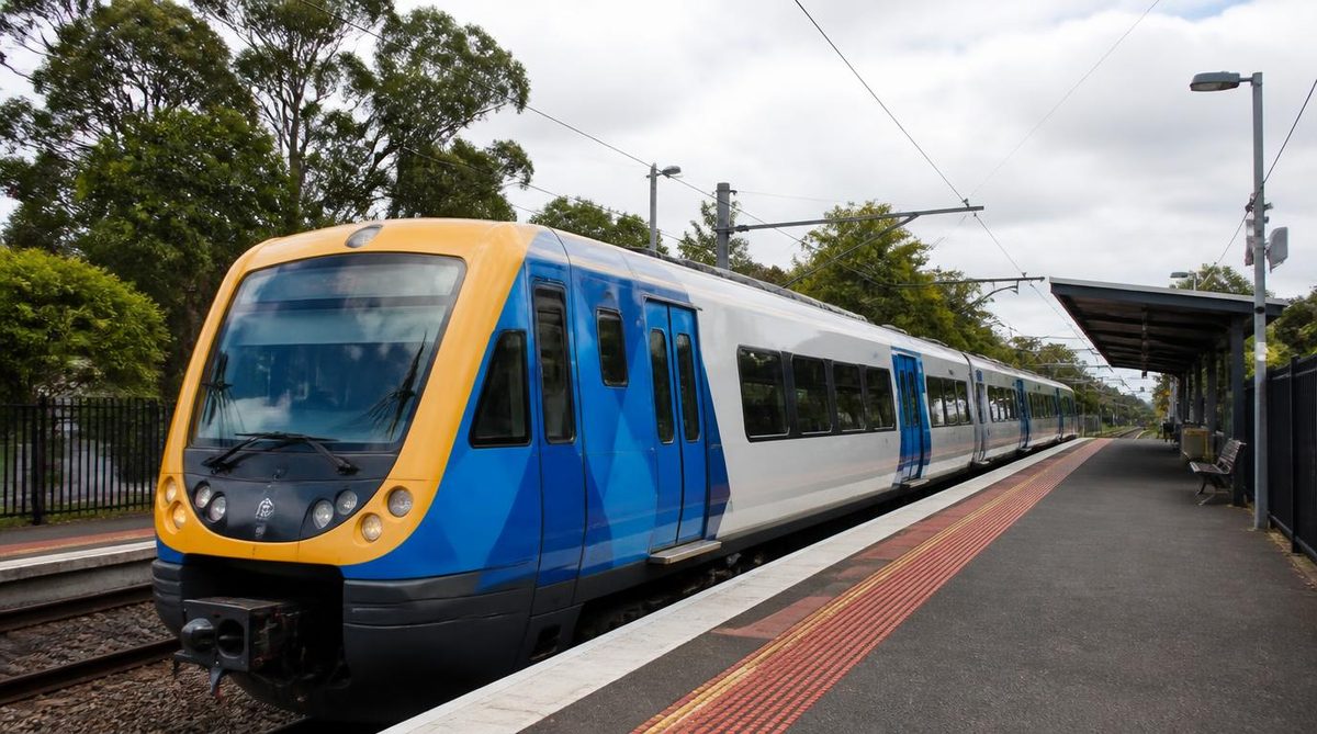
Lilydale is generally considered an outer eastern suburb of Melbourne, not a rural town. It sits where suburban Melbourne meets the more open country of the Yarra Valley, so it can look and feel rural in parts. That setting does not give Lilydale one universal rural status.
The clearest everyday description is an outer Melbourne suburb on the rural-urban fringe. If the question affects a visa, grant, health service or another formal application, you must check the definition used by that specific program. Government systems do not all draw the same boundaries or use the words rural and regional in the same way. outer eastern suburb
Why is Lilydale usually described as a suburb?
Lilydale has the main features people expect from an established outer suburb. It has a defined town centre, residential streets, schools, shops and local services. The Lilydale line connects it to Melbourne's wider rail network. Homes and businesses form a settled urban area rather than a small community separated from metropolitan development.
The word suburb does not mean inner city or densely packed. Melbourne suburbs range from busy areas near the Melbourne central business district to lower-density places near the edge of the city. Lilydale sits toward that outer edge.
This is where ordinary language can cause trouble. Some people use rural to mean any place with open land, large blocks or a country feel. Under that loose meaning, parts of Lilydale may seem rural. Yet appearance alone does not settle how the whole suburb should be described.
A working farm is rural in character. A nearby street of detached homes with rail access and town services is suburban in character. Both settings can exist close together near a city boundary. Lilydale's identity comes from that meeting point.
Its distance from central Melbourne can also shape how people speak about it. A long trip into the city may make a place feel separate from metropolitan life. Distance is still a weak test. A suburb does not become rural simply because it lies far from the city centre.
For a profile, property description or ordinary conversation, calling Lilydale an outer eastern Melbourne suburb gives the reader the right starting point. Adding that it sits near the rural edge of Melbourne explains the scenery without changing the basic answer.
Why does Lilydale feel more rural than many Melbourne suburbs?
Lilydale sits on the rural-urban fringe. This is the transition zone where continuous suburban development begins to meet larger properties, farmland, bushland and smaller settlements.
The change is often easy to notice while travelling east. Lilydale has a busy centre and suburban streets. Farther toward the Yarra Valley, buildings become less continuous and open land becomes more common. The shift does not happen at one dramatic line on the ground. Development changes over distance.
That explains why two descriptions can sound reasonable in casual speech. A commuter may focus on Lilydale's train service and residential centre, then call it suburban. A visitor arriving through open country may focus on paddocks and the gateway to the Yarra Valley, then describe it as rural. They are noticing different parts of the same edge setting.
The phrase gateway to the Yarra Valley also shapes Lilydale's image. It places the suburb beside an area widely linked with farms, wineries and country travel. A gateway, however, is an entry point. It does not mean the gateway has the same land use as every place beyond it.
Recreation adds to the rural impression. Routes such as the Lilydale to Warburton Rail Trail lead from a serviced suburban centre toward less densely settled country. Parks and open views can make the transition feel close. These features describe access and atmosphere. They do not create a single official rural classification.
The useful distinction is between rural character and rural status. Character describes what a place looks and feels like. Status depends on the boundary and rules chosen for a defined purpose. Lilydale has clear rural influences while remaining suburban in the most common description.
Does being in the Shire of Yarra Ranges make Lilydale rural?
No. Lilydale is part of the Shire of Yarra Ranges, but council membership does not make every locality inside that municipality rural.
A local government area can contain several settlement types. The Shire covers established suburban centres as well as valleys, ranges, farms and sparsely settled land. One council boundary can serve residents whose surroundings differ greatly.
The word shire often creates the wrong impression. Many people link it with country councils because shires commonly cover broad rural areas. In Victoria, the name of a municipality is not a land-use test for every address within it.
Think of the suburb and municipality as two different map layers. The suburb identifies the locality of an address. The municipality identifies the council responsible for local government functions. Those layers answer different questions.
A Lilydale address can therefore be within a shire and still sit in a suburban centre. The wider municipality's rural land does not transfer a rural label to every home, shop or street in Lilydale.
This matters when reading council material. A report about rural communities in the Yarra Ranges may concern selected districts rather than the entire Shire. A service offered across the whole municipality may include Lilydale even if its title refers to the broader region. Read the stated boundary instead of making a decision from the council name.
The same care helps with property searches. A listing may use words such as country lifestyle to describe space, views or nearby farmland. That is marketing language about the property experience. It is not proof of an administrative classification.
Why can official classifications give different answers?
Australia does not use one definition of rural or regional for every purpose. Statistical systems, migration programs, grants and health services may each divide places according to their own goals.
A statistical system may classify an area by settlement size or population distribution. A service program may focus on access to care. A funding body may publish its own eligible location list. A migration rule may define designated areas through postcodes or named boundaries.
These systems can produce labels that do not match normal conversation. A place commonly known as a Melbourne suburb could fall within a broad regional category under one scheme. Another scheme could place the same address within a metropolitan service area. Neither result changes the physical place. Each result answers a different policy question.
Regional and rural are not synonyms. Regional may refer to territory outside a boundary chosen for a program, including large towns or outer urban areas. Rural usually suggests lower settlement density or land use associated with the countryside. Official documents may define either word more narrowly.
Census information also needs careful reading. The 2016 Australian census and the 2021 Australian census provide data about people and dwellings within defined geographic units. They do not create one permanent answer that every agency must use for rural eligibility. An agency may rely on another classification or a newer boundary set.
Do not treat an old search result as a current ruling. Program areas can change, and pages about past application years may remain online. Check the current rules, effective date and location list on the authority's own website.
Use the full address when possible. Lilydale's postcode, 3140, can help when a scheme publishes a postcode list. A postcode match is useful only when the rules say eligibility is based on postcodes. If a program uses suburb names, mapped zones or property boundaries, the postcode alone may not settle the question.
What should you check before relying on a formal label?
Start with the reason you need the answer. Then find the current classification published for that exact purpose.
- For a visa: check the current migration instrument or official eligibility tool for the relevant visa pathway.
- For a grant: read the grant guidelines and its list or map of eligible locations.
- For health access: use the geographic system named by the service or incentive program.
- For statistics: identify the census geography or classification used in the dataset.
Record the version or date of the source when the decision matters. A screenshot of a general map or a real estate description is weaker evidence than the program's own current list.
If the result remains unclear, give the authority the full Lilydale address and ask for written confirmation. That prevents a broad claim about the suburb from being applied to a property that may sit near a mapped boundary.
Which description should you use in everyday writing?
Use “an outer eastern Melbourne suburb on the rural-urban fringe” when you need a clear general description. It states Lilydale's suburban role while recognising its position beside the more open Yarra Valley.
Use semi-rural only when describing a setting, lifestyle or particular property that truly has those features. The term can help readers picture large blocks or nearby farmland. It should not replace a formal category.
Avoid calling Lilydale simply rural when the audience needs geographic accuracy. That wording can suggest a detached country town with limited metropolitan links. It leaves out Lilydale's established centre and connection to the Melbourne rail network.
Also avoid saying that Lilydale is regional as though that settles every official question. The term may be correct inside a named scheme and misleading outside it. State the scheme whenever eligibility is involved.
For example, a general description could say: “Lilydale is an outer eastern Melbourne suburb at the gateway to the Yarra Valley.” A formal statement should instead say: “Lilydale is included under the current definition used by this program,” followed by the authority and date. Use the first form for place. Use the second only after checking the rules.
Action: Describe Lilydale as an outer Melbourne suburb on the rural-urban fringe, then verify postcode 3140 or the full address against the current official list whenever money, access or eligibility depends on the label.